We've meant to hike in the Superstition Mountains for quite a while. It was hard.
"Superstition Mountains" is a cool name, made cooler by the fact that the Lost Dutchman gold mine is allegedly in there somewhere.
After a 70-minute drive, the last seven on a dirt road, we arrived at the Peralta trailhead. We came prepared for a fairly strenuous hike of about six miles and a bit over 1500 feet elevation gain. Due to circumstances I'll go into later, it turned out to be much harder than expected.
But at the start, we had no idea how things would turn out, and enjoyed the scenery at the parking lot.


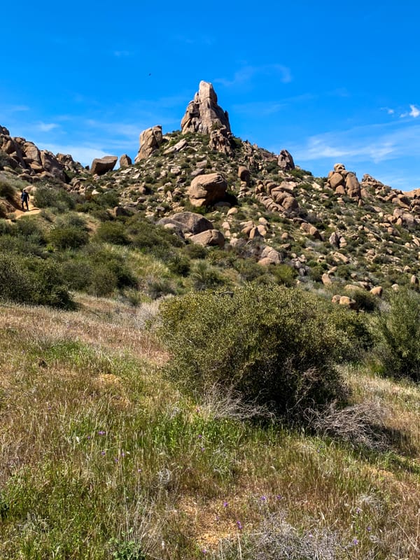
Right from the start, it was clear that this would be an interesting hike. The area was more green and the mountains made for impressive rock formations. Up the steadily climbing trail we go.


After a final few switchbacks, the steepest part of the climb, we arrived at the saddle and got our first view of Weavers Needle. This landmark plays an important part in the legend of the Lost Dutchman mine. The Needle's shadow reportedly indicates the location of a rich vein of gold. Many treasure hunters have searched for it.

We headed for the needle overlook that's just above Mary Anne's hat.


Lunchtime, well a power bar and water, with a fine view of Weavers Needle and the sky.


After lunch, we made a decision that changed our hike from a strenuous walk into something much more difficult.
Rather than return the way we came, we took the advice of our AllTrails app and decided to follow a different trail. This would make our hike a circular route rather than out-and-back.
Rather than follow the valley, descending steadily, the new trail stayed high following a rocky path.


We expected to find something like a switchback trail when we reached the end of the rocks, instead we found ourselves scrambling, and sometimes making short vertical drops.
This was how we spent the next two hours, during which my camera battery died. So, no more photos for you.
There would have been no more trail guidance for us, but fortunately, Mary Anne's phone had a little charge left. Enough to get us back to the valley floor.